Adventure Radio |
|
How qsomap determines the locations
(last update: 16-FEB-2023)
|
- in your logupload is the QTH locator (ADIF field Gridsquare)
- If the QTH locator has 4 digits, the centre field is selected as the QTH (e.g. JO32 = JO32MM).
- The QTH locator can contain 6, 8 or 10 characters.
- The log analyzer does not work with 2-digit locators.
- there is no locator in your log
- First, the QTH locator database is checked to see if the call of the worked station is present. If so, the QTH locator saved there is used.
- If the call is not found in the locator database, the locator from the DXCC file is used. Usually this is the capital city. For example, if the call is F1XYZ in your logbook, without a locator, the location will be Paris.
- In countries where you can see the approximate location from the callsign (e.g. Sweden, Russia, ...) the location will be the capital or a large city of that callsign region (e.g. RA6XYZ = UA6X = Kabardino-Balkaria = Nalchick = LN15TM).
- the country file (DXCC file) is still from the contest program "QW" by DL4MFM est. 1989 and is maintained from time to time. You can find out which location is determined for a callsign here:
Callsign check
- The callsign/locator file is filled from the uploaded logs. 4-digit QTH locators from FT8 logs are set to the centre field.
Display Edit and Download Locators
We have now 419898 callsigns in the locator database.
- Specials:
- the ADIF fields <MY_LAT>, <MY_LON>, <LAT> and <LON> overwrite the locator fields <MY_GRIDSQUARE> and <GRIDSQUARE>
- if you upload an ADIF file with <MY_SOTA_REF> and/or <SOTA_REF> then the location is read from the GMA database and overwrites all other details. This field can also contain a GMA reference
- if you upload an ADIF file with <MY_GMA_REF> and/or <GMA_REF> then the location is read from the GMA database and overwrites all other details
- If you call up QSOMAP via your GMA logbook (www.cqgma.net), your activation location will be taken from the GMA database (until now only for mountains) and displayed exactly, worked stations of summit-to-summit QSOs are also displayed directly in the activation zone.
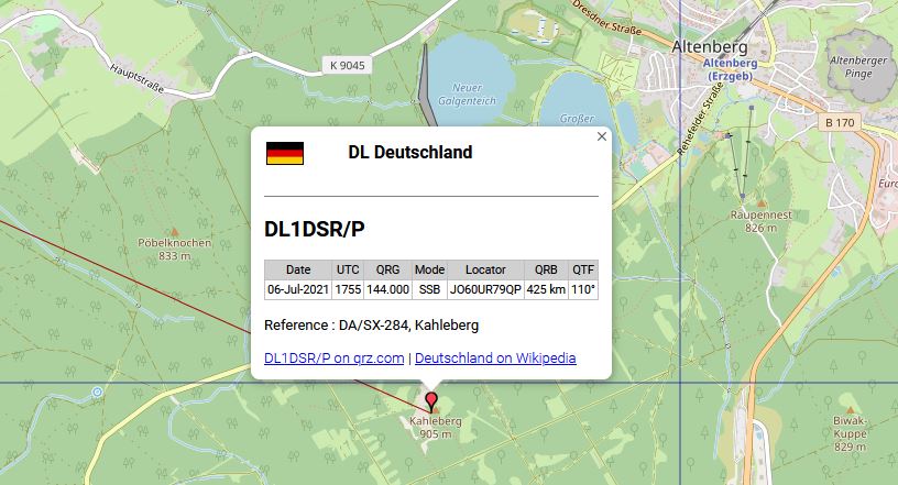
- the reference and the reference name are displayed if you click on the QSO pin.
- Many display errors are caused by incorrect log data. If a QSO is displayed completely incorrectly, check your ADIF file.
Are the correct Maidenhead locators in the GRIDQUARE or MY_GRIDSQUARE fields? Are the coordinates under MY_LAT/MY_LON/LAT/LON correct?
Is there an incorrect QTH locator in the database? A very good tool for cecking ADIF files is ADIF Master
- (26-FEB-2024) Attention: Some logbook programs have non-ADIF compliant geographic coordinates in the ADIF fields lat & lon
(e.g. LOG4OM, FLE). Ham Radio Deluxe often has only zeros in the coordinates, e.g. <lat:11>E000 00.000 . Probably there are more log programs.
Incorrect information can lead to display errors. If incorrect or 0-coordinates are detected, they are ignored by the Log Analyzer as far as possible.
Workaround: export without lat/lon, if this is not possible, open your adif file with ADIF Master and delete lat/lon columns, then upload to Log Analyzer
- (26-JUL-2021) Attention: Unfortunately, many incorrect qth locators were uploaded to the database. The database was actually unusable and many OMs wrote to me in amazement.
Thats why I decided to compare the data with the locators in qrz.com. All base callsigns have now been synchronised,
about every fourth QTH locator was wrong. Access to qrz.com is subject to a fee, if you like to
 buy me a cup of coffee

Kartendaten OpenStreetMap-Mitwirkende, SRTM - Veröffentlicht unter ODbL
- Error messages or suggestions for improvement are welcome, send an e-mail to my e-mail address.
|
Go back to the home page
|
made by DL4MFM 2005, 2024
Title Image: Kartendaten OpenStreetMap-Mitwirkende, SRTM - Veröffentlicht unter ODbL |
Kartendarstellung: OpenTopoMap (CC-BY-SA)
|
|